


Page 25 - Home Buyers and Sellers Guide - Hawaii
P. 25
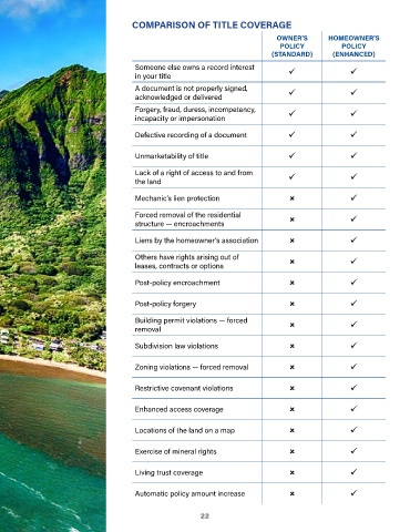
COMPARISON OF TITLE COVERAGE

                                                                                    OWNER’S        HOMEOWNER’S
                                                                                     POLICY            POLICY
                                                                                  (STANDARD)        (ENHANCED)

                                         Someone else owns a record interest
                                         in your title

                                         A document is not properly signed,
                                         acknowledged or delivered
                                         Forgery, fraud, duress, incompetency,
                                         incapacity or impersonation

                                         Defective recording of a document


                                         Unmarketability of title

                                         Lack of a right of access to and from
                                         the land

                                         Mechanic’s lien protection

                                         Forced removal of the residential
                                         structure — encroachments

                                         Liens by the homeowner’s association

                                         Others have rights arising out of
                                         leases, contracts or options


                                         Post-policy encroachment


                                         Post-policy forgery

                                         Building permit violations — forced
                                         removal

                                         Subdivision law violations


                                         Zoning violations — forced removal


                                         Restrictive covenant violations


                                         Enhanced access coverage


                                         Locations of the land on a map


                                         Exercise of mineral rights


                                         Living trust coverage


                                         Automatic policy amount increase


                                                             22

